UN PROJET, UNE QUESTION ? APPELEZ-NOUS AU +33(0)4 65 84 71 20 - contact@instadrone.fr

Instadrone

  • NETWORK
  • SERVICES
    • Telecommunication
      • Panoramic
      • Inspection
      • Microwave Targeting
      • Pathloss Report
      • Roof modeling
      • Prospecting Assistance
    • Topography
      • Photogrammetry
      • Bathymetry
      • Multispectral
      • Lidar
    • Modelisation
      • Structures
      • BIM
      • Examples of Achievements
    • Inspection Sampling
      • Engineering structure
      • Wind Farm
      • Thermal inspection
      • Worksite monitoring
      • Underwater inspection and aquatic sampling
    • Agricultural Services
    • Instadrone’s Formation
      • Formation UgCS
      • Formation DJI Phantom 4 RTK
      • Map Pilot Formation
  • NEWS
  • CONTACT US
  • English
    • Français
    • English
    • Español
  • Home
  • NEWS
  • AR Instadrone
  • UX-11 DELAIR
Monday, 22 March 2021 / Published in AR Instadrone

UX-11 DELAIR

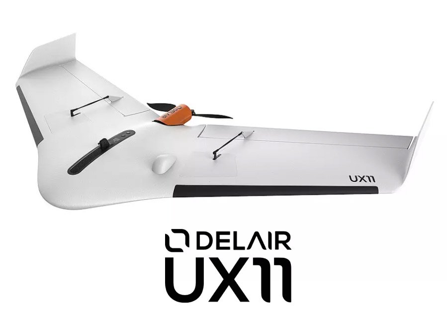
وكجزء من تعاون وتدريب مشغلي إنستادرون على الرحلات الجوية S4 على DELAIR DT26 ، اقتنينا نسخة أولى من UX-11 المساعدة على رسم الخرائط الثابتة.

لقد عمل مهندسو ديلاير جنبا إلى جنب مع شركتهم الفرعية غيتونغ لتقديم نظام فريد من نوعه في العالم وأفضل نظام في طبقته: النظام BTOL.

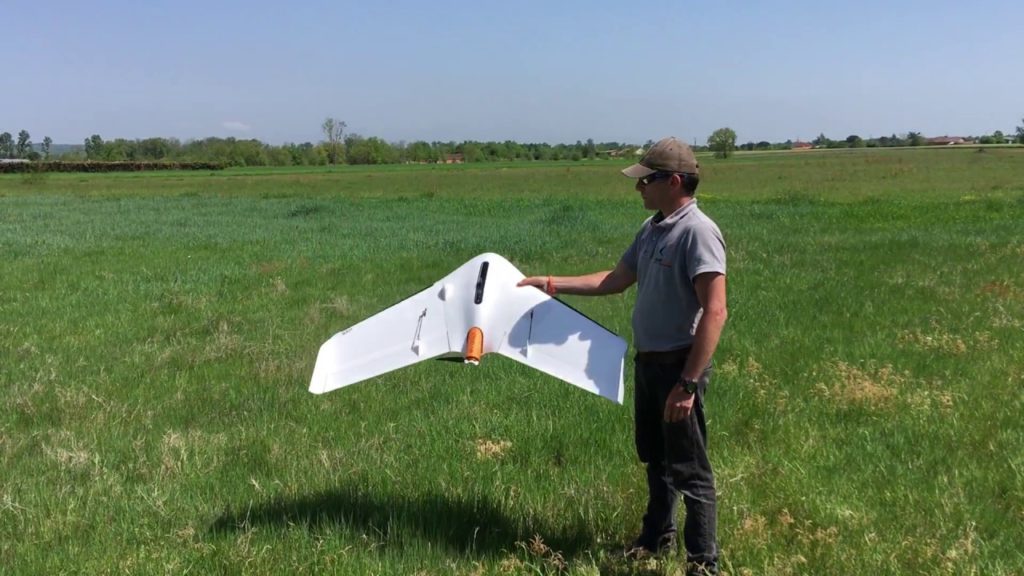
ومن أجل الإقلاع ، تطلق الطائرة بدون طيار UX11 ببساطة كبيرة بفضل يد واحدة. صعود المنحدرات المنحدرة مثير للإعجاب ، آلة متموجة إلى ما قبل الاندريه من الأماكن المقيدة.

فريدة من نوعها في العالم ، UX11 تشكل مثل الطيور! ويسمح معدل النزوح البالغ 30 درجة بالهبوط بشكل عادل وقصير. جهاز استشعار ليزر الارتفاع يتحكم في الفرامل وتقريب قوية وقريبة من الأرض لهبوط قصير وآمن.

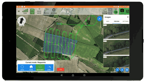
هذا UX11 مثمر جدا بفضل تحمله للطيران 59 مينا مقترنة بمدى طيران طويل. لا حاجة للتضحية بالحل من أجل الإنتاجية عندما يمكنك الحصول على كلاهما. في رحلة واحدة ، يمكنك رسم خريطة 120 هكتار في 120 متر والحصول على 1.7 سم GSD.

  • Tweet
Tagged under: 3D achievements, advice, ALPHA 7RIV, aquatic sampling, autonome, bathymetry, building information modeling, dji, drone, engineering structures, formation, gps, innovation, inspection, instadrone, lidar, microwave targeting, modeling, multispectral, network, pathloss report, photogrammetry, prospecting assistance, roof modeling, S4, services, suez, wind domain, worksite monitoring

Recent Posts

  • Instadrone integrates the ITS Fusion network of companies

    The network of companies ITS Fusion, the first ...
  • Why use a service provider for drone services?

    Drones are an industry that has grown exponenti...
  • Instadrone participation in the scientific expedition “Antartique 2.0°”

    Among the partners of the INSTADRONE expedition...
  • INSTADAYS 2021

    As every year Instadrone organizes INSTADAYS, a...
  • Acquisition of a Multinov ROView Terrestrial ROV

    We proposed to you up to the gold of the perfor...
Logo POCTEFA
  • NETWORK
  • SERVICES
    • Telecommunication
    • Topography
    • Modelisation
    • Inspection Sampling
    • Agricultural Services
    • Formation
    • Communication
  • NEWS
  • CONTACT US
  • English
    • Français
    • English
    • Español
  • LEGAL NOTICE
  • GET SOCIAL

© 2025 INSTADRONE - Tous droits réservés

TOP
We use cookies to ensure the best experience on our website. If you continue to use this site, we will assume that you are satisfied with it.