UN PROJET, UNE QUESTION ? APPELEZ-NOUS AU +33(0)4 65 84 71 20 - contact@instadrone.fr

Instadrone

  • RÉSEAU
  • SERVICES
    • TÉLÉCOMMUNICATION
      • Panoramique
      • Visée FH
      • Rapport pathloss
      • Inspection
      • Modélisation de toiture
      • Photomontages
      • APD
    • TOPOGRAPHIE
      • Photogrammétrie
      • Lidar
      • Multispectral
      • BIM
    • INSPECTION – PRELEVEMENT
      • Drone automatisé Hoverseen
      • Ouvrage d’art
      • Inspection espace confiné
      • Eolien
      • Inspection thermique
      • Suivi de chantier
      • Inspection aquatique et subaquatique
    • PRESTATIONS AGRICOLES
    • INSTADRONE ACADEMY
    • COMMUNICATION
  • ACTUALITÉS
  • CONTACT
  • Projet Niu Link
  • Français
    • Français
    • English
    • Español
    • Português
    • العربية المغربية
    • Polonais
    • Italien
  • Home
  • Actualités
  • Non classé
  • Topographie, un nouveau cas d’usage
mardi, 11 juillet 2023 / Published in Non classé

Topographie, un nouveau cas d’usage

🗺 TOPOGRAPHIE 🗺

Merci à notre fournisseur de Lidar aéroporté YellowScan pour ce cas d’usage et le focus sur nos activités topographiques. 🙏 🚀
#topographie#Lidar#Survey

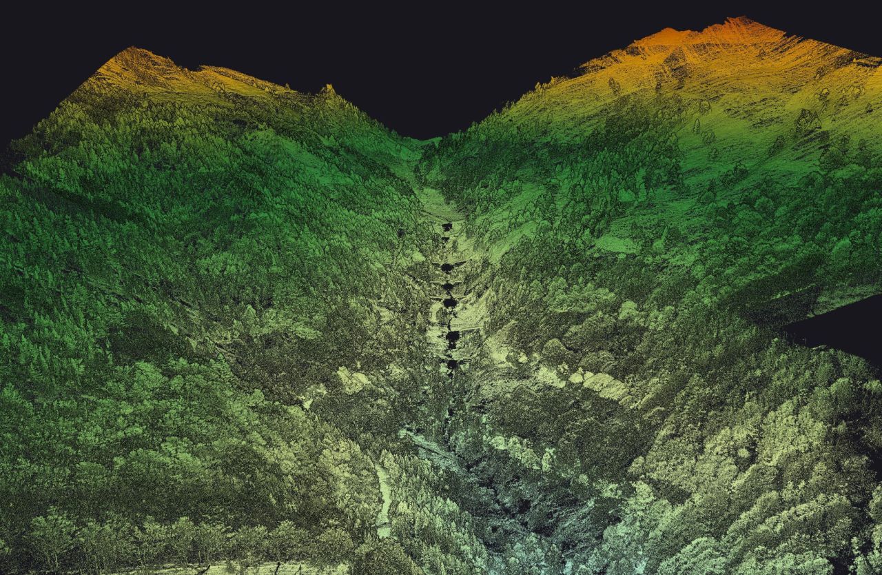
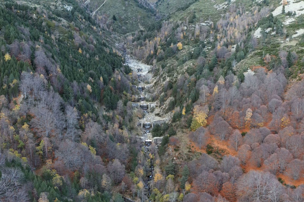
 » Our customer Instadrone undertook a comprehensive LiDAR survey to model 4 avalanche corridors in the French Pyrenees covering a total area of 430 hectares (1 060 ac.). 🏔️

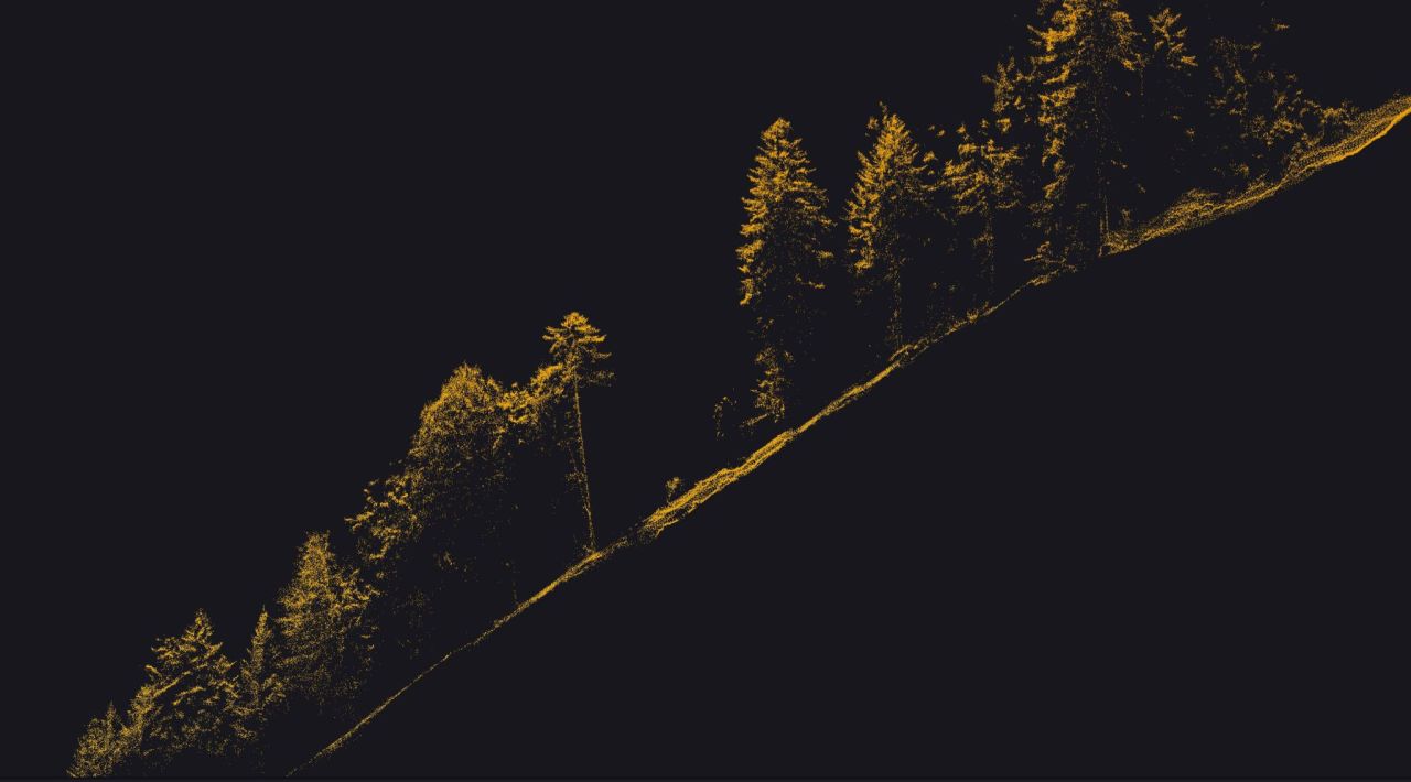
These areas undergo regular updates to ensure accuracy and relevancy. Their primary requirement was to use a LiDAR system integrated with an M300 RTK, enabling efficient and rapid surveying of the mountainous terrain with its challenging features, such as steep slopes, rugged landscapes, and densely forested areas. The survey spanned 2.3 kilometers (1.4 miles) and featured a maximum elevation difference of 1000 meters (about 3300 ft.), presenting the most challenging section of the project.

To fulfill these requirements, Instadrone were tasked to collect LiDAR data using their YellowScan Explorer LiDAR system.

Mission parameters:
📋 Survey size: 4 zones totaling 430 ha. (1 060 ac.)
📋 Duration:
– Half a day for flight preparation – decision-making on speed, altitude, double grid or not, takeoff point, GCP placement, backup pivot location for the IGN reference point, etc.
– Approximately 6 hours of flight time
– Processing: 1 day for POSPac + YellowScan CloudStation, followed by a full week of dedicated time for ground/surface classification in third-party software.
📋 Number of flights: 7 flights: 3 flights for the largest zone (176 ha./435 ac.), 2 flights for 148 ha. (366 ac.), and the remaining 2 flights for two smaller zones.
📋 Flight speed and altitude: Speed of 5 m/s at a height of 120 m AGL.
📋 Equipment:
– YellowScan Explorer LiDAR system
– DJI M300 RTK drone
– Trimble R4S GNSS receiver + CORS network for control
– POSPac software
– YellowScan CloudStation with Strip Adjustment module
– No camera – uncolored point cloud

Results:
✔️ Point density: minimum 100 pts per square meter (depending on if under trees or not)
✔️ Accuracy: between 5 and 10 cm XYZ

Read the full success story here: https://bit.ly/3OaaeNM

#LiDAR#Surveying#Mapping « 

  • Tweet

What you can read next

Emmanuel Macron, en RDC
Le DCF Awards 2023 remporté par Instadrone
Retour sur la campagne agricole 2023 🇫🇷🇪🇸🇵🇹

Laisser un commentaire Annuler la réponse

Votre adresse e-mail ne sera pas publiée. Les champs obligatoires sont indiqués avec *

Recent Posts

  • Instadrone à l’international

    Instadrone becomes an international group and d...
  • Instadrone au forum Energaïa 2023

    Retour sur la premiere journée du salon Énergaï...
  • Le DCF Awards 2023 remporté par Instadrone

    C’est avec une grande fierté que je vous ...
  • Cédric Botella, notre CEO mis à l’honneur

    Retour sur la soirée « Les Biterrois qui gagnen...
  • Nos collaborateurs ont du talent

    Depuis son arrivée chez INSTADRONE GROUP,&...
Logo POCTEFA
  • RÉSEAU
  • SERVICES
    • TÉLÉCOMMUNICATION
    • TOPOGRAPHIE
    • INSPECTION – PRELEVEMENT
    • PRESTATIONS AGRICOLES
    • INSTADRONE ACADEMY
    • COMMUNICATION
  • ACTUALITÉS
  • CONTACT
  • Français
    • Français
    • English
    • Español
    • Português
    • العربية المغربية
    • Polonais
    • Italien
  • MENTIONS LÉGALES
  • Poctefa
  • GET SOCIAL

© 2025 INSTADRONE - Tous droits réservés

TOP
Nous utilisons des cookies pour vous garantir la meilleure expérience sur notre site web. Si vous continuez à utiliser ce site, nous supposerons que vous en êtes satisfait.Ok