UN PROJET, UNE QUESTION ? APPELEZ-NOUS AU +33(0)4 65 84 71 20 - contact@instadrone.fr

Instadrone

  • NETWORK
  • SERVICES
    • Telecommunication
      • Panoramic
      • Inspection
      • Microwave Targeting
      • Pathloss Report
      • Roof modeling
      • Prospecting Assistance
    • Topography
      • Photogrammetry
      • Bathymetry
      • Multispectral
      • Lidar
    • Modelisation
      • Structures
      • BIM
      • Examples of Achievements
    • Inspection Sampling
      • Engineering structure
      • Wind Farm
      • Thermal inspection
      • Worksite monitoring
      • Underwater inspection and aquatic sampling
    • Agricultural Services
    • Instadrone’s Formation
      • Formation UgCS
      • Formation DJI Phantom 4 RTK
      • Map Pilot Formation
  • NEWS
  • CONTACT US
  • English
    • Français
    • English
    • Español
    • Português
    • العربية المغربية
    • Polonais
    • Italien
  • Home
  • NEWS
  • Instadrone-EN
  • Topography Phantom 4 RTK
Monday, 06 April 2020 / Published in Instadrone-EN

Topography Phantom 4 RTK

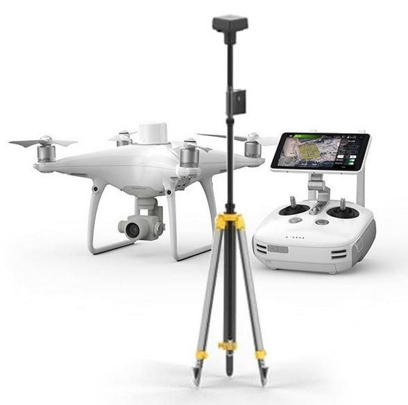
For photogrammetric captures that are as precise as they are resolved, the INSTADRONE network uses its DJI Phantom RTK drones to the maximum of their ability thanks to the monitoring of the topography coupled with the RTK correction of the TERIA network allowing a constant GSD.

Possessing beautiful tools is good, mastering them is better.

DJI Phantom RTK
  • Tweet
Tagged under: 3D achievements, advice, ALPHA 7RIV, aquatic sampling, autonomous, bathymetry, building information modeling, dji, drone, engineering structures, formation, gps, innovation, inspection, instadrone, lidar, microwave targeting, modeling, multispectral, network, pathloss report, phantom, photogrammetry, prospecting assistance, roof modeling, services, telecommunication, topography, wind domain, worksite monitoring

What you can read next

Instadays 2019
Iliad to associate Instadrone with its development in Italy and Poland
When to use an underwater ROV drone?

Recent Posts

  • Instadrone integrates the ITS Fusion network of companies

    The network of companies ITS Fusion, the first ...
  • Why use a service provider for drone services?

    Drones are an industry that has grown exponenti...
  • Instadrone participation in the scientific expedition “Antartique 2.0°”

    Among the partners of the INSTADRONE expedition...
  • INSTADAYS 2021

    As every year Instadrone organizes INSTADAYS, a...
  • Acquisition of a Multinov ROView Terrestrial ROV

    We proposed to you up to the gold of the perfor...
Logo POCTEFA
  • NETWORK
  • SERVICES
    • Telecommunication
    • Topography
    • Modelisation
    • Inspection Sampling
    • Agricultural Services
    • Formation
    • Communication
  • NEWS
  • CONTACT US
  • English
    • Français
    • English
    • Español
    • Português
    • العربية المغربية
    • Polonais
    • Italien
  • LEGAL NOTICE
  • GET SOCIAL

© 2025 INSTADRONE - Tous droits réservés

TOP
We use cookies to ensure the best experience on our website. If you continue to use this site, we will assume that you are satisfied with it.Ok