UN PROJET, UNE QUESTION ? APPELEZ-NOUS AU +33(0)4 65 84 71 20 - contact@instadrone.fr

Instadrone

  • RÉSEAU
  • SERVICES
    • TÉLÉCOMMUNICATION
      • Panoramique
      • Visée FH
      • Rapport pathloss
      • Inspection
      • Modélisation de toiture
      • Photomontages
      • APD
    • TOPOGRAPHIE
      • Photogrammétrie
      • Lidar
      • Multispectral
      • BIM
    • INSPECTION – PRELEVEMENT
      • Drone automatisé Hoverseen
      • Ouvrage d’art
      • Inspection espace confiné
      • Eolien
      • Inspection thermique
      • Suivi de chantier
      • Inspection aquatique et subaquatique
    • PRESTATIONS AGRICOLES
    • INSTADRONE ACADEMY
    • COMMUNICATION
  • ACTUALITÉS
  • CONTACT
  • Projet Niu Link
  • Français
    • Français
    • Español
  • Home
  • Instadrone-EN
  • UX-11 DELAIR
lundi, 22 mars 2021 / Published in Instadrone-EN

UX-11 DELAIR

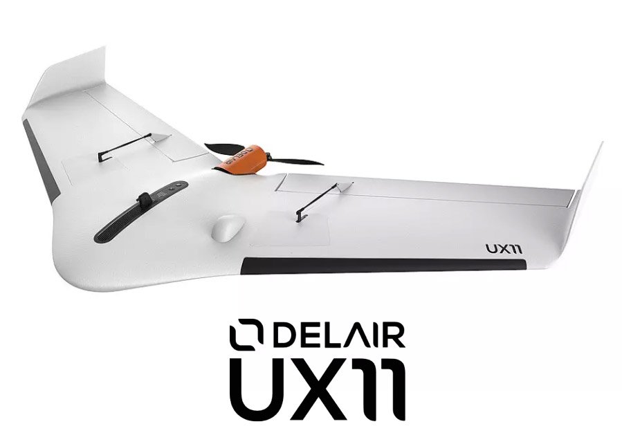
As part of the collaboration and training of Instadrone operators on S4 flights on the DELAIR DT26, we have acquired a first copy of the fixed mapping aid UX-11.

Delair engineers worked hand in hand with their subsidiary Gatewing to offer a system that is unique in the world and the best in its class: the BTOL.

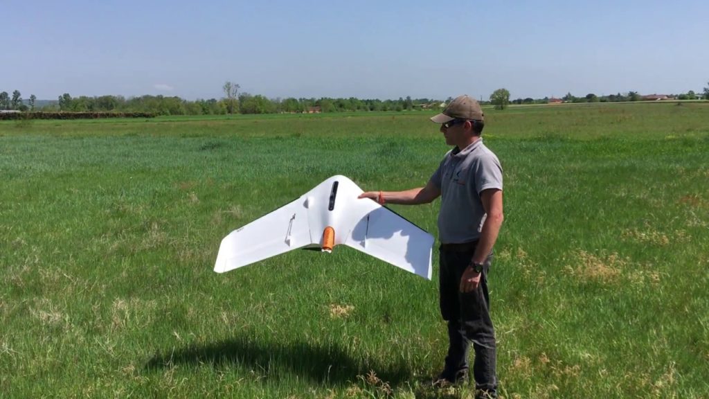
For take-off the UX11 drone launches with great simplicity thanks to a single hand. Its climb slope is impressive, allowing the machine to take off from constrained places.

Unique in the world, the UX11 poses like a bird! The descent incidence of 30° allows a fair and short landing. An altitude laser sensor controls braking and rounding strong and close to the ground for a short and safe landing.

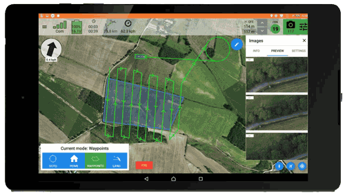
The UX11 is very productive thanks to its 59 min flight endurance combined with a long flight range. No need to sacrifice resolution for productivity when you can have both. In a single flight, you can map 120 ha at 120 m and get a 1.7 cm GSD.

  • Tweet
Tagged under: 3D achievements, advice, ALPHA 7RIV, aquatic sampling, autonomous, bathymetry, building information modeling, dji, drone, engineering structures, formation, gps, innovation, inspection, instadrone, lidar, microwave targeting, modeling, multispectral, network, pathloss report, photogrammetry, prospecting assistance, roof modeling, S4, services, suez, wind domain, worksite monitoring

Recent Posts

  • CAS D’USAGE FORMATION / LOCATION DRONES

    Depuis maintenant 4 ans, SUEZ loue des drones à...
  • Livraison médicale par drone

    INSTADRONE GROUP est heureux de participer à la...
  • DJI Dock 3 chez COVED – PAPREC GROUP

    Nous vous avions annoncé le début des vent...
  • Instadrone au Forum EnerGaïa

    INSTADRONE GROUP sera présent au Forum EnerGaïa...
  • AGRICULTURE – Recherche opérateurs

    Hier s’est tenue la réunion de préparatio...
Logo POCTEFA
  • RÉSEAU
  • SERVICES
    • TÉLÉCOMMUNICATION
    • TOPOGRAPHIE
    • INSPECTION – PRELEVEMENT
    • PRESTATIONS AGRICOLES
    • INSTADRONE ACADEMY
    • COMMUNICATION
  • ACTUALITÉS
  • CONTACT
  • Français
    • Français
    • Español
  • MENTIONS LÉGALES
  • Poctefa
  • GET SOCIAL

© 2025 INSTADRONE - Tous droits réservés

TOP
Nous utilisons des cookies pour vous garantir la meilleure expérience sur notre site web. Si vous continuez à utiliser ce site, nous supposerons que vous en êtes satisfait.