UN PROJET, UNE QUESTION ? APPELEZ-NOUS AU +33(0)6 64 94 96 32 - contact@instadrone.fr

Instadrone

  • HOME
  • SERVICES
    • Telecommunication
      • Panoramic
      • Inspection
      • Microwave Targeting
      • Pathloss Report
      • Roof modeling
      • Prospecting Assistance
    • Topography
      • Photogrammetry
      • Bathymetry
      • Multispectral
      • Lidar
    • Modelisation
      • Structures
      • BIM
      • Examples of Achievements
    • Inspection Sampling
      • Engineering structure
      • Wind Farm
      • Thermal inspection
      • Worksite monitoring
      • Underwater Inspection
      • Aquatic sampling
    • Agricultural Services
    • Formation / Consulting
  • NEWS
  • CONTACT US
  • EnglishEnglish
    • FrançaisFrançais
    • EnglishEnglish
    • EspañolEspañol
    • PortuguêsPortuguês
    • العربية المغربيةالعربية المغربية
  • Home
  • NEWS
  • Instadrone-EN
  • DRONES GEOPHYSICS
Saturday, 20 July 2019 / Published in Instadrone-EN

DRONES GEOPHYSICS

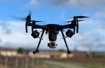
New combined acquisition of Lidar and magnetometric data in order to produce a 3D geological model with our partner CVA Group. From Lidar data, we have produced a map of topographic lineaments to approach the structural geology and a very accurate digital terrain model (XYZ < 5 cm) to secure the navigation of the UAV, which was flying 50 m above the ground and 25 m above the canopy (shiver guaranteed…). As for the magnetic data, their spatial resolution is 25 m with an acquisition along these profiles every 50 cm and a positioning accuracy of the order of a metre. Next step: processing of all these data in order to draw up a map of the magnetic field corrected for diurnal variations (20 nTesla of amplitude, cf. the data from our ground base station) and to detect areas of heterogeneity, before moving on to modeling and interpretation by a CVA geologist! A first in France, this combined acquisition of Lidar and magnetic data to help refine the geological map of the zone! For your next acquisitions, consider TOPOLIDAR and TESLAMAPPER.


  • Tweet
Tagged under:3D achievements, advice, ALPHA 7RIV, aquatic sampling, autonomous, bathymetry, building information modeling, dji, drone, engineering structures, formation, gps, innovation, inspection, instadrone, lidar, microwave targeting, modeling, multispectral, network, pathloss report, phantom, photogrammetry, prospecting assistance, roof modeling, services, telecommunication, topography, wind domain, worksite monitoring

What you can read next

Start of Lidar capture
Update DJI RTK
SONY ALPHA 7R IV

Leave a Reply Cancel reply

Your email address will not be published. Required fields are marked *

Recent Posts

  • DJI M300 RTK Instadrone

    The Matrix 300 RTK is DJI's latest commercial p...
  • Instadrone in ANGOLA

    Our representatives in Angola, Paulo Da Silva a...
  • Topography Phantom 4 RTK

    For photogrammetric captures that are as precis...
  • Update DJI RTK

    In particular, we have validated the use of KML...
  • “Pavillons Bleus 2020”

    INSTADRONE is preparing for the 2020 "Pavillons...
  • HOME
  • SERVICES
    • Telecommunication
    • Topography
    • Modelisation
    • Inspection Sampling
    • Agricultural Services
    • Formation / Consulting
  • NEWS
  • CONTACT US
  • EnglishEnglish
    • FrançaisFrançais
    • EnglishEnglish
    • EspañolEspañol
    • PortuguêsPortuguês
    • العربية المغربيةالعربية المغربية
  • GET SOCIAL

© 2020 Tous droits réservés

TOP
We use cookies to ensure the best experience on our website. If you continue to use this site, we will assume that you are satisfied with it.Ok