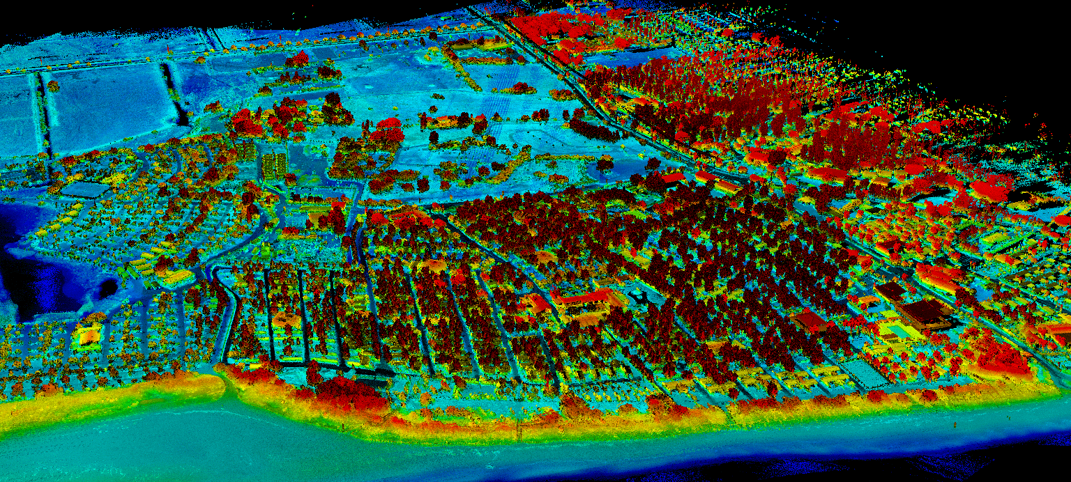
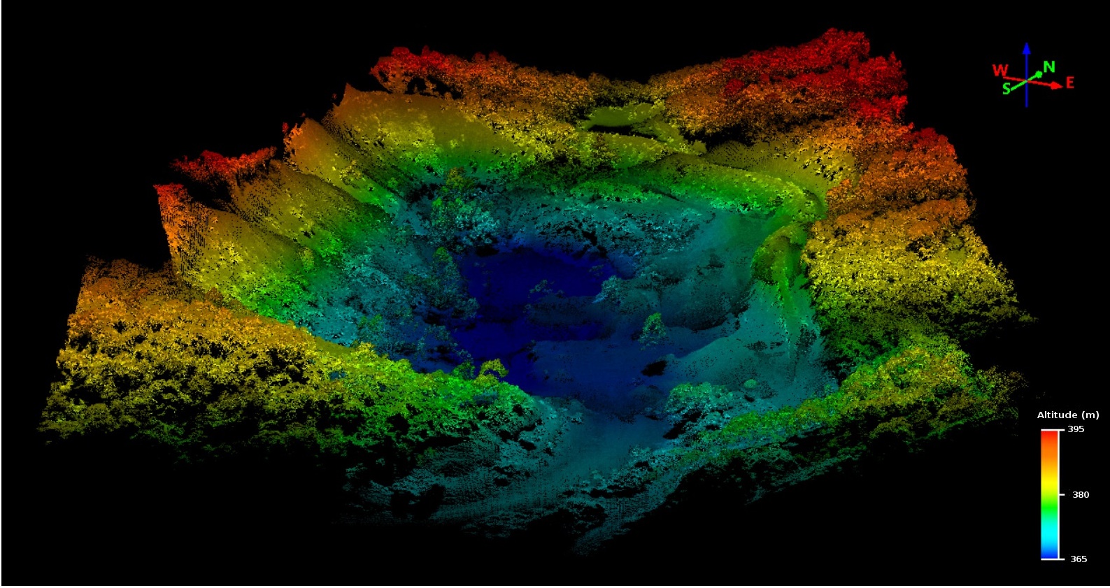
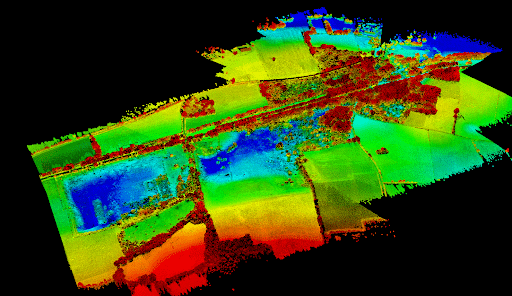
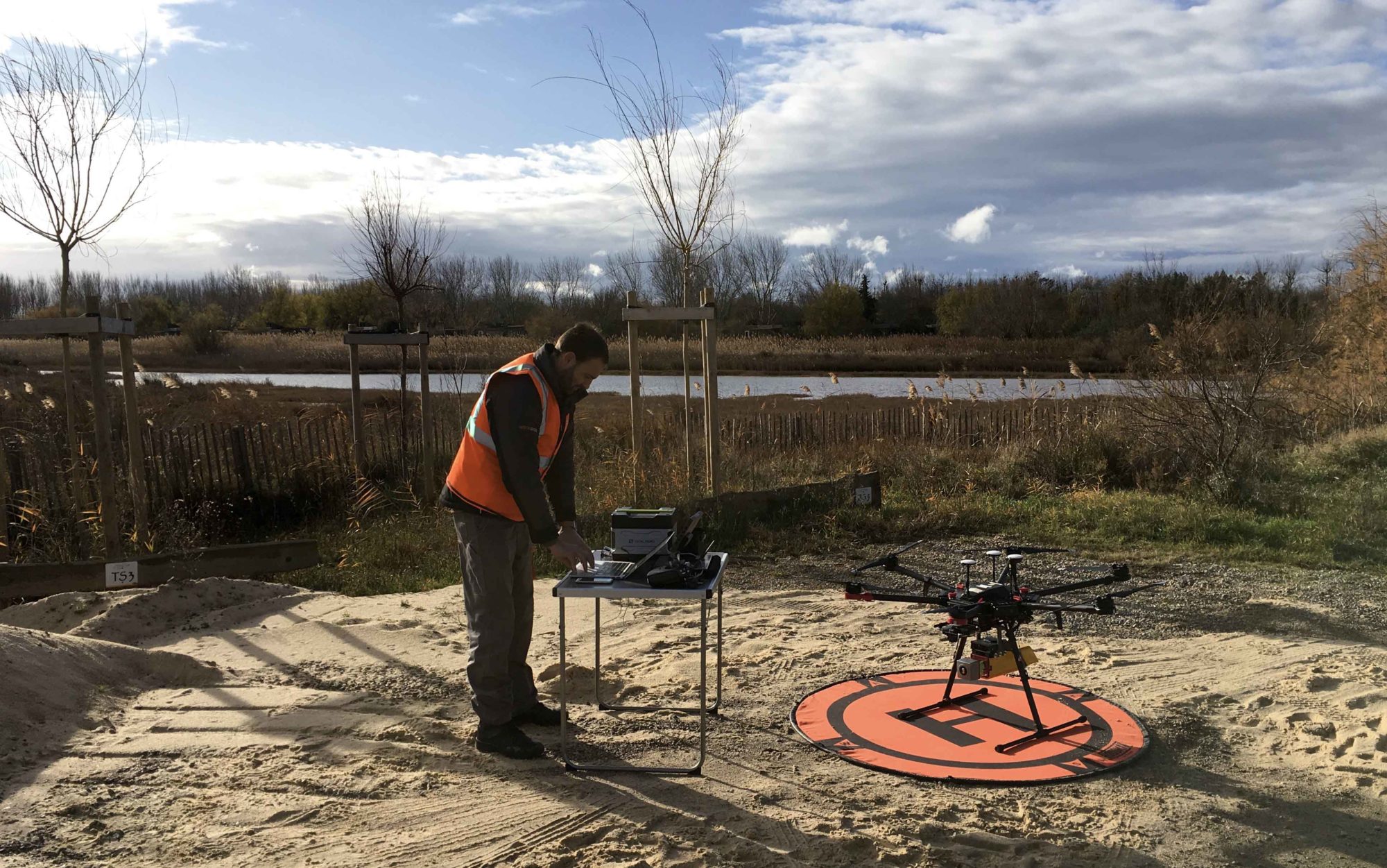
LiDAR by drone is an innovative surveying and mapping service for uneven and vegetated terrain, applicable to many sectors (solar and wind power plants, waste storage sites, mines and quarries, natural hazards, etc.) with demanding requirements for precision topographic surveys.

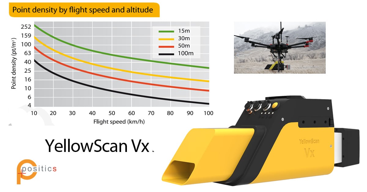
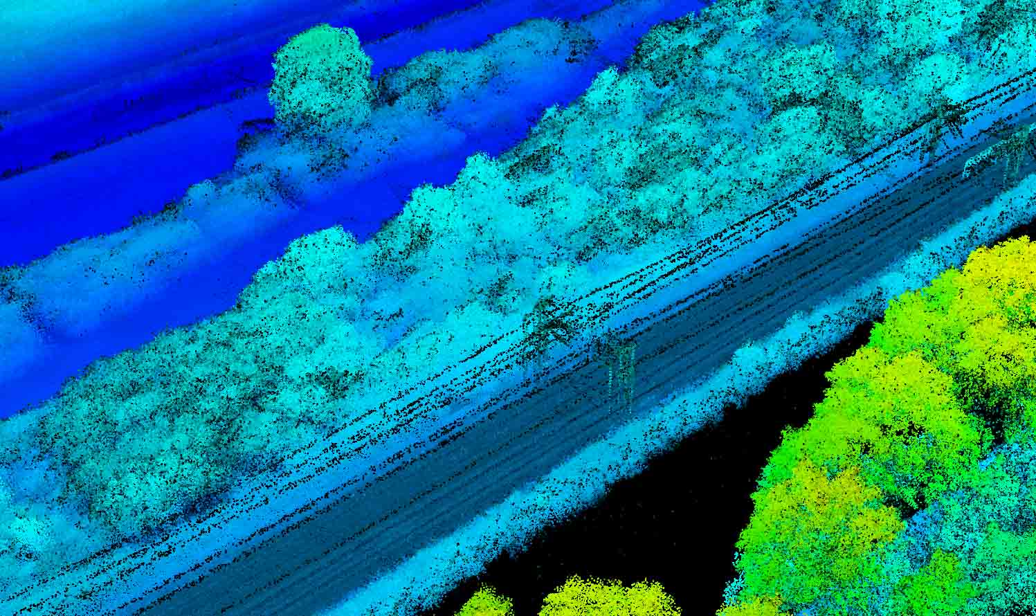
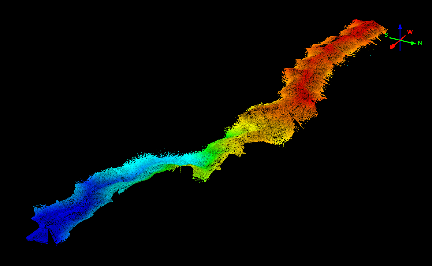
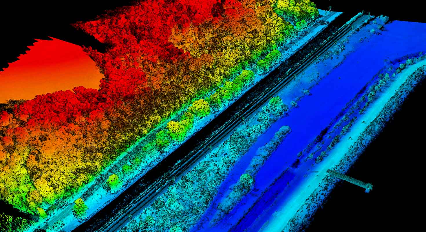
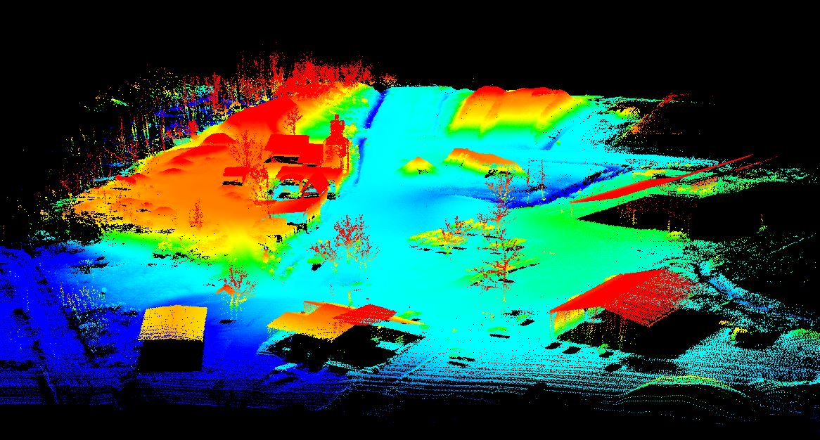
The Lidar sensor is embarked on a rotary wing UAV in order to provide a fine geographical information of the terrain or its vegetation) with very high spatial resolution and density of measurement points.

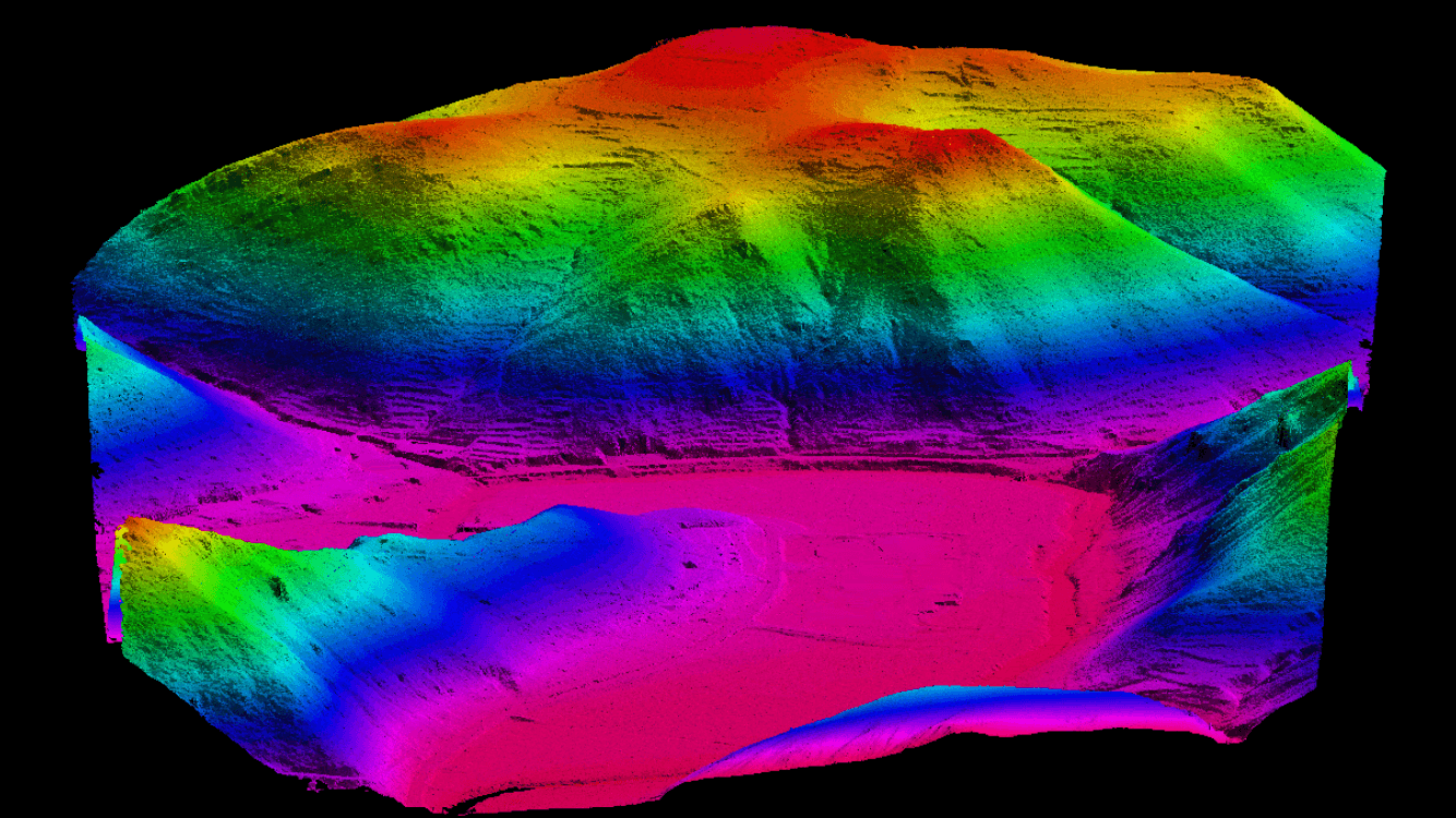
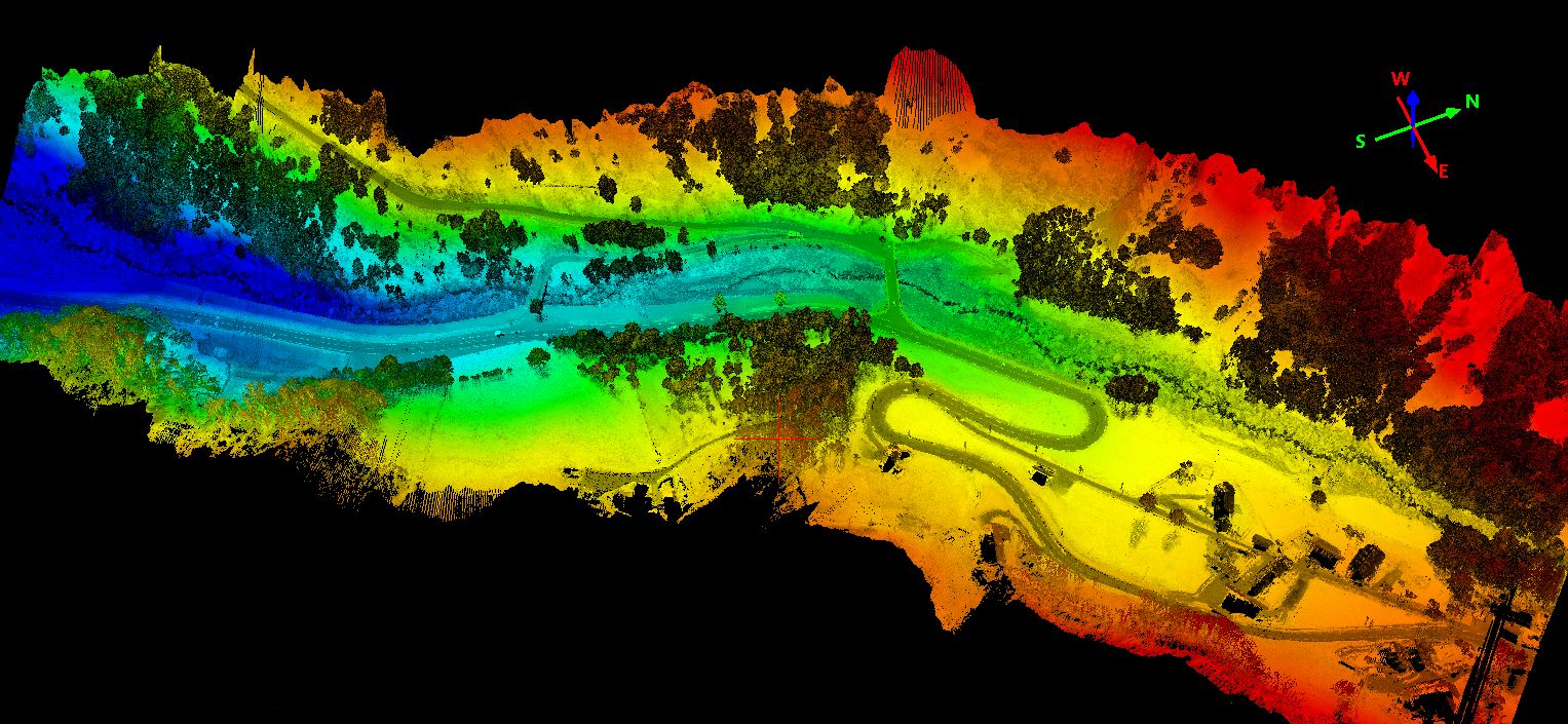
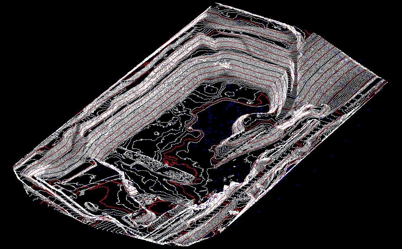
Our design office is committed to developing and implementing quality services thanks to the Lidar. Able to penetrate vegetation with great precision, our airborne solutions adapt to all types of terrain and can quickly generate precise point clouds (compatible with GIS / CAD systems).

With more than 4,000 hectares surveyed in France and abroad, in often demanding conditions, Instadrone has become a reference in the execution of this service. The mastery of our UAVs and automated flight applications allow us to perform 100% of the services ordered. 

Our solutionsINSTADRONE

The strength of our offer is the complete control of the service, from the capture to the delivery of the deliverables validated by our surveyor.

Agencies

The operators of our 23 agencies are trained in this type of service and in the management of flight plans with topographical monitoring. We intervene quickly and at a lower cost throughout France and abroad.

Domains

Our fields of application are vast: "Solar and wind power plants, waste storage sites, mines and quarries" or even "Industrial or road infrastructure, study of natural risks" as well as "Hydraulic projects, forestry management, archaeological prospection".

Specialists

Our specialists manage information processing in order to provide you with topographic surveys of high quality. If cadastral information is required, our surveyor will provide the essential added value for your needs.

Technical Equiment

DJI M600 Pro equipped Lidar VX Yellowscan

The DJI M600 Pro UAV is the ideal tool for safely transporting the sensor and making flight plans with specific parameters.

YellowScan VX

Trimble R4S

Trimble R4S

M210 LIDAR S3 - Instadrone

TOP