THE DRONE FOR AGRICULTURE


Optimizing input supply

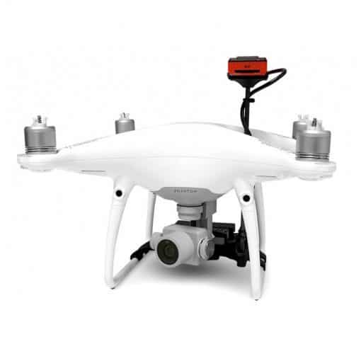
In a real flying laboratory, the UAV carries one or more sensors depending on the measurements to be taken: biomass estimation, chlorophyll rate, water stress or simple imagery (for example to estimate damage done by pests or to locate diseased trees in a forest).

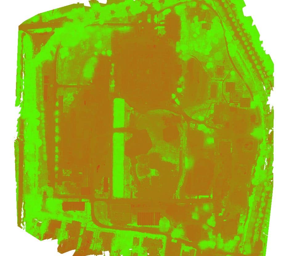
Once the raw data taken during the overflight have been collected, the information still needs to be analysed and interpreted in order to derive concrete recommendations. With what the mapping will have revealed, it will be possible to fine-tune the inputs according to the zones of the plot, and to target the areas where to intervene.

The applications are numerous: calculating nitrogen fertilizer doses (wheat and rapeseed), monitoring biomass production (pastures), estimating game or lodging damage and, in the future, detecting leaf diseases and weeds.

The uses of UAVs are evolving as fast as their technologies. Soon it will be possible to directly integrate the data acquired by the UAV into precision farming software, for example to control fertilizer spreaders.

The Parrot SEQUOIA+ multispectral sensor is revolutionising the sector by offering a complete, adaptable and compatible solution for all UAVs. Thanks to its two sensors, multispectral and sunshine, Sequoia+ analyses the vitality of plants by capturing the amount of light they absorb and then reflect. This data collection allows the farmer to act on his plots in an optimal way.

The Instadrone network, in collaboration with oenological engineers, is developing a capture and analysis protocol for viticulture. This service will soon be marketed.

Optimize your agricultural yield and make savings

Capture with high-tech precision

Technical Equiment

An ALL IN ONE solution


The P4M is above all a compact drone: a weight lower than 1,5kg, and a diagonal from engine to engine of 35cm (open category A2 limited and A3 limited). This small size makes it easy to carry and deploy.

The first advantage of the DJI Phantom 4 Multispectral is its built-in multispectral sensor from the factory. It replaces some solutions that required adapting an external sensor to the aircraft. With the P4M, there are no software or hardware modifications to make. Stabilized on 3 axes, its sensor collects images in flight with great precision and at an angle maintained at nadir (oriented at 90° downwards).


The main sensor of the P4M is based on 6 sensors with the following characteristics:

- Sensors: 6 CMOS of 1/2.9 inch and 2.12 MP (1 RGB for the visible part and 5 monochrome for the multispectral part)

- Filters: Red-edge (RE) ~ 730nm +/- 16nm; Near infrared (NIR) ~ 840nm +/- 26nm; Green (V) ~ 560nm +/- 16nm; Red (R) ~ 650nm +/- 16nm; Blue (B) ~ 650nm +/- 16nm

- Lenses: FOV (field of view) 62.7°; focal length 5.74mm (35mm equivalent: 40mm); auto focus set to ∞; equal aperture of f/2.2

- Other: RGB sensor ISO range: 200 - 800; monochrome sensor sleeve:

1 - 8 x; electronic global shutter: 1/1000 - 1/20000 s (visible part), 1/100 - 1/10000 s (multispectral part)


The images are saved in JPEG format for the visible RGB sensor and in TIFF format for the monochrome sensors. The TIFF format allows the images to be imported and processed by software suites such as Pix4Dfields, DJI Terra, Agisoft Metashape or QGIS.

DJI's TimeSync system promises centimeter accuracy of the image positioning data. It permanently synchronizes the flight controller, the 6 sensor cameras and the integrated RTK module.

The other main feature is the live NDVI function. With this function, the operator can visualize live vegetation indices such as NDVI, NDRE or GNDVI; very useful to identify from the field the areas requiring special attention.

Finally, the DJI Phantom 4 Multispectral ranks among the best value solutions on the market, with a sensor of the same size as the Parrot Sequoia, a reference in the sector.

Sequoia multispectral camera

DJI Phantom 4 Pro

NDVI map on an eco-neighborhood for Eiffage

Ebee

NDWI

TOP