UN PROJET, UNE QUESTION ? APPELEZ-NOUS AU +33(0)4 65 84 71 20 - contact@instadrone.fr

Instadrone

  • NETWORK
  • SERVICES
    • Telecommunication
      • Panoramic
      • Inspection
      • Microwave Targeting
      • Pathloss Report
      • Roof modeling
      • Prospecting Assistance
    • Topography
      • Photogrammetry
      • Bathymetry
      • Multispectral
      • Lidar
    • Modelisation
      • Structures
      • BIM
      • Examples of Achievements
    • Inspection Sampling
      • Engineering structure
      • Wind Farm
      • Thermal inspection
      • Worksite monitoring
      • Underwater inspection and aquatic sampling
    • Agricultural Services
    • Instadrone’s Formation
      • Formation UgCS
      • Formation DJI Phantom 4 RTK
      • Map Pilot Formation
  • NEWS
  • CONTACT US
  • English
    • Français
    • English
    • Español
    • Português
    • العربية المغربية
    • Polonais
    • Italien
  • Home
  • NEWS
  • Instadrone-EN
  • Instadrone participation in the scientific expedition “Antartique 2.0°”
Thursday, 23 September 2021 / Published in Instadrone-EN

Instadrone participation in the scientific expedition “Antartique 2.0°”

Among the partners of the INSTADRONE expedition chose to participate by training Lana Lenourry, one of the students The association juste 2° is organizing its first expedition to Antarctica, the aim of which is to send 6 scientific students aboard a travelling laboratory on a boat for 6 months to assess the impact of global warming on nature.

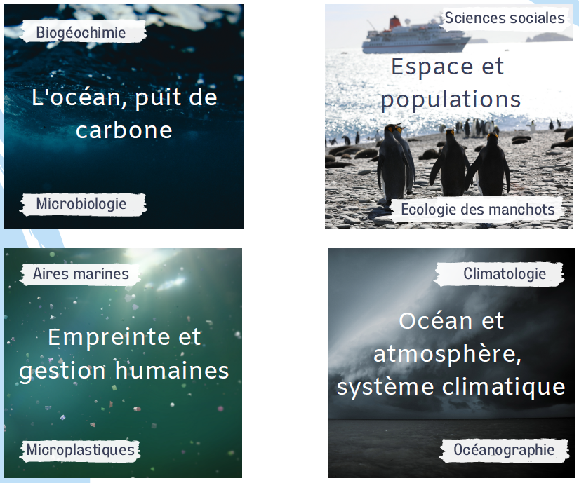
Each student will carry out research among the following 4 themes:

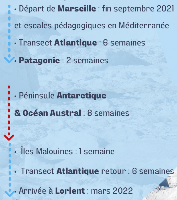
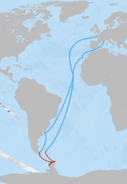
Le Trajet de l’équipe :

Among the partners of the INSTADRONE expedition chose to participate by training Lana Lenourry, one of the students of the expedition so that she can obtain the professional drone telepilot certificate necessary for her mission to observe the penguins and their habitat using drones.

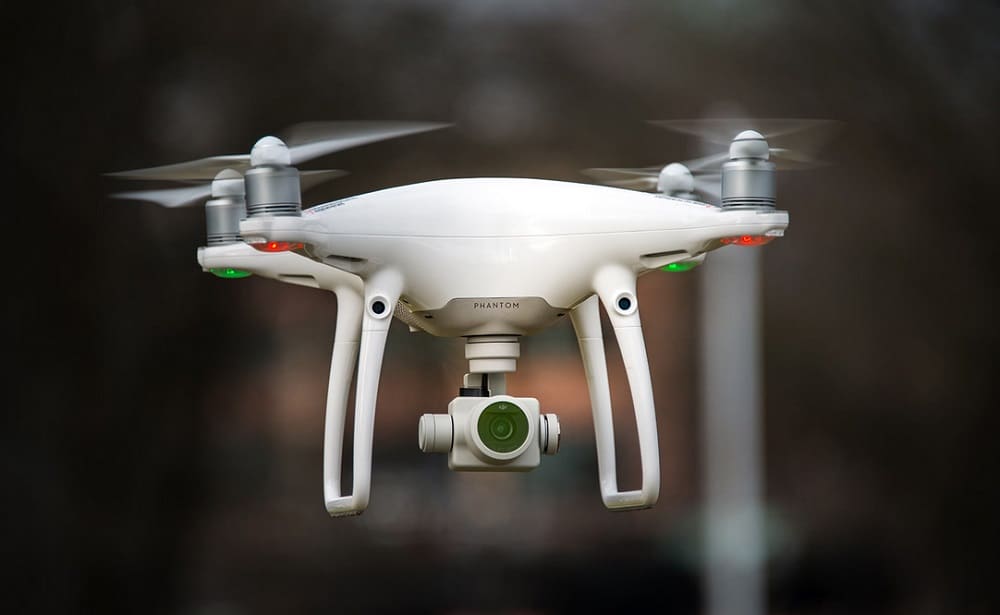
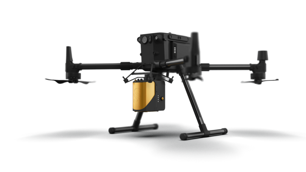
We also lend equipment including a DJI M300 RTK and a DJI Phantom 4 Pro V2, two DJI drones allowing Lana Lenourry to carry out her photogrammetric and LIDAR survey missions.

Do not hesitate to follow them on the social networks for the follow-up of the expedition:

Linkedin : https://www.linkedin.com/company/antar2d/?viewAsMember=true

Instagram : https://www.instagram.com/antarctique2.0c/

Twiter : https://twitter.com/Antarctique_2C

Facebook : https://www.facebook.com/profile.php?id=100049526025432

  • Tweet

What you can read next

Purchase of the Tundra THE 100% French modular drone
Why use a service provider for drone services?
Topography Phantom 4 RTK

Leave a Reply Cancel reply

Your email address will not be published. Required fields are marked *

Recent Posts

  • Instadrone integrates the ITS Fusion network of companies

    The network of companies ITS Fusion, the first ...
  • Why use a service provider for drone services?

    Drones are an industry that has grown exponenti...
  • INSTADAYS 2021

    As every year Instadrone organizes INSTADAYS, a...
  • Acquisition of a Multinov ROView Terrestrial ROV

    We proposed to you up to the gold of the perfor...
  • Acquisition of an underwater ROV Deep Trekker DT3

    In order to complete our panel of aquatic servi...
Logo POCTEFA
  • NETWORK
  • SERVICES
    • Telecommunication
    • Topography
    • Modelisation
    • Inspection Sampling
    • Agricultural Services
    • Formation
    • Communication
  • NEWS
  • CONTACT US
  • English
    • Français
    • English
    • Español
    • Português
    • العربية المغربية
    • Polonais
    • Italien
  • LEGAL NOTICE
  • GET SOCIAL

© 2025 INSTADRONE - Tous droits réservés

TOP
We use cookies to ensure the best experience on our website. If you continue to use this site, we will assume that you are satisfied with it.Ok