UN PROJET, UNE QUESTION ? APPELEZ-NOUS AU +33(0)6 64 94 96 32 - contact@instadrone.fr

Instadrone

  • NETWORK
  • SERVICES
    • Telecommunication
      • Panoramic
      • Inspection
      • Microwave Targeting
      • Pathloss Report
      • Roof modeling
      • Prospecting Assistance
    • Topography
      • Photogrammetry
      • Bathymetry
      • Multispectral
      • Lidar
    • Modelisation
      • Structures
      • BIM
      • Examples of Achievements
    • Inspection Sampling
      • Engineering structure
      • Wind Farm
      • Thermal inspection
      • Worksite monitoring
      • Underwater inspection and aquatic sampling
    • Agricultural Services
    • Instadrone’s Formation
      • Formation UgCS
      • Formation DJI Phantom 4 RTK
      • Map Pilot Formation
  • NEWS
  • CONTACT US
  • EnglishEnglish
    • FrançaisFrançais
    • EnglishEnglish
    • EspañolEspañol
    • PortuguêsPortuguês
    • العربية المغربيةالعربية المغربية
    • PolonaisPolonais
    • ItalienItalien
  • Home
  • NEWS
  • Instadrone-EN
  • Geophysical survey
Monday, 22 March 2021 / Published in Instadrone-EN

Geophysical survey

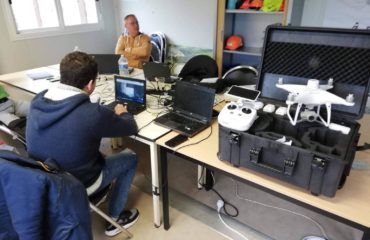
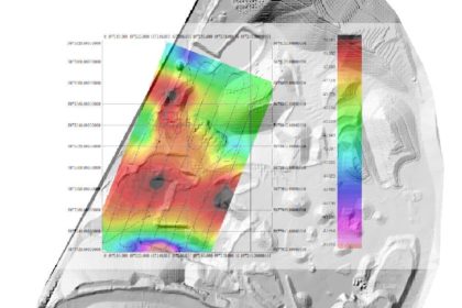
As part of our collaboration with the INFOGEO design office, we recently carried out a magnetometric capture by drone in a pouzollane quarry near Clermond-Ferrand. The peculiarity of this survey is the flight altitude since we flew over the entire quarry at 12m altitude following the actual altimetry of the site. This was made possible by the integration of a recent TAM from the site into our flight planning software. Another big step taken by the Instadrone teams in the mastery of technical captures.

  • Tweet
Tagged under: 3D achievements, advice, ALPHA 7RIV, aquatic sampling, autonomous, bathymetry, building information modeling, dji, drone, engineering structures, formation, gps, innovation, inspection, instadrone, lidar, microwave targeting, modeling, multispectral, network, pathloss report, photogrammetry, prospecting assistance, roof modeling, services, suez, telecommunication, wind domain, worksite monitoring

What you can read next

Elios 2
Visual Inspect and Instadrone
UX-11 DELAIR
Iliad to associate Instadrone with its development in Italy and Poland

Recent Posts

  • Instadrone integrates the ITS Fusion network of companies

    The network of companies ITS Fusion, the first ...
  • Why use a service provider for drone services?

    Drones are an industry that has grown exponenti...
  • Instadrone participation in the scientific expedition “Antartique 2.0°”

    Among the partners of the INSTADRONE expedition...
  • INSTADAYS 2021

    As every year Instadrone organizes INSTADAYS, a...
  • Acquisition of a Multinov ROView Terrestrial ROV

    We proposed to you up to the gold of the perfor...
  • NETWORK
  • SERVICES
    • Telecommunication
    • Topography
    • Modelisation
    • Inspection Sampling
    • Agricultural Services
    • Formation
    • Communication
  • NEWS
  • CONTACT US
  • EnglishEnglish
    • FrançaisFrançais
    • EnglishEnglish
    • EspañolEspañol
    • PortuguêsPortuguês
    • العربية المغربيةالعربية المغربية
    • PolonaisPolonais
    • ItalienItalien
  • LEGAL NOTICE
  • GET SOCIAL

© 2022 INSTADRONE Tous droits réservés

TOP