UN PROJET, UNE QUESTION ? APPELEZ-NOUS AU +33(0)4 65 84 71 20 - contact@instadrone.fr

Instadrone

  • RÉSEAU
  • SERVICES
    • TÉLÉCOMMUNICATION
      • Panoramique
      • Visée FH
      • Rapport pathloss
      • Inspection
      • Modélisation de toiture
      • Photomontages
      • APD
    • TOPOGRAPHIE
      • Photogrammétrie
      • Lidar
      • Multispectral
      • BIM
    • INSPECTION – PRELEVEMENT
      • Drone automatisé Hoverseen
      • Ouvrage d’art
      • Inspection espace confiné
      • Eolien
      • Inspection thermique
      • Suivi de chantier
      • Inspection aquatique et subaquatique
    • PRESTATIONS AGRICOLES
    • INSTADRONE ACADEMY
    • COMMUNICATION
  • ACTUALITÉS
  • CONTACT
  • Projet Niu Link
  • Français
    • Français
    • Español
  • Home
  • Instadrone-EN
  • Archive from category "Instadrone-EN"
  • Page 3
  • 0
Instadrone
lundi, 22 mars 2021 / Published in Instadrone-EN

Geophysical survey

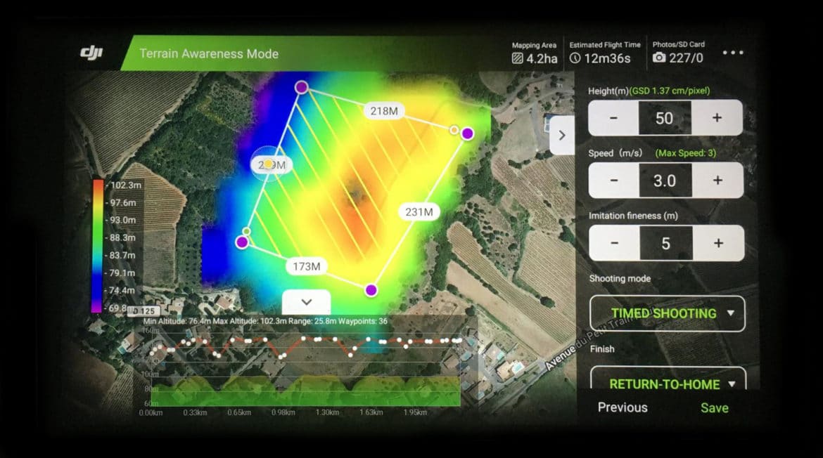
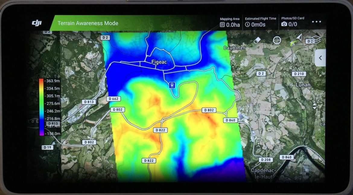
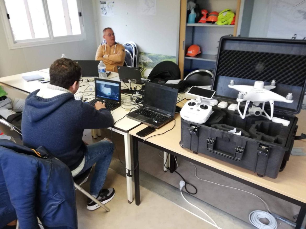
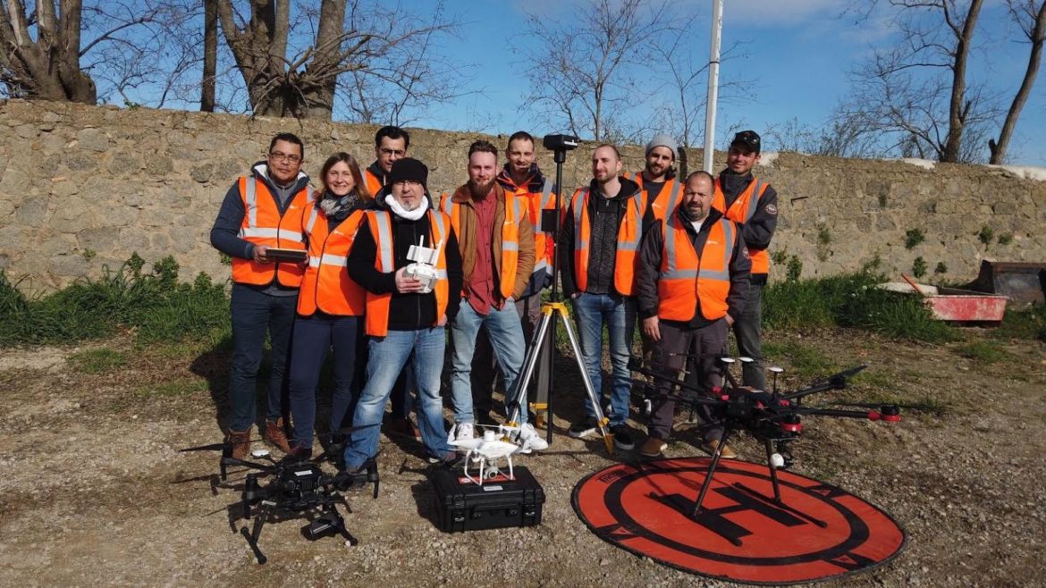
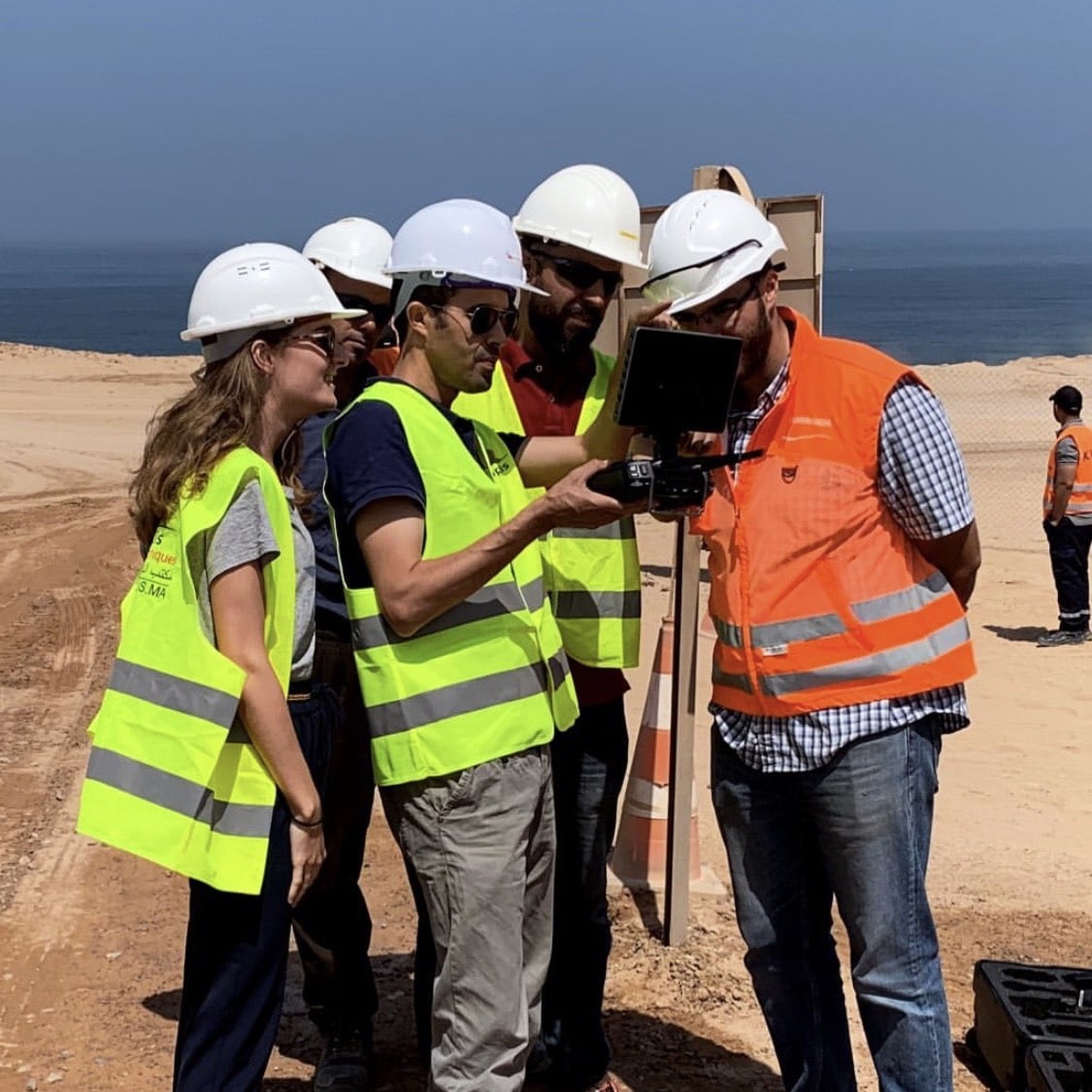
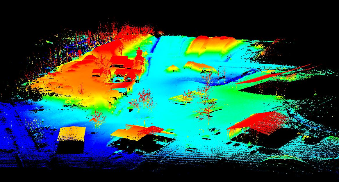
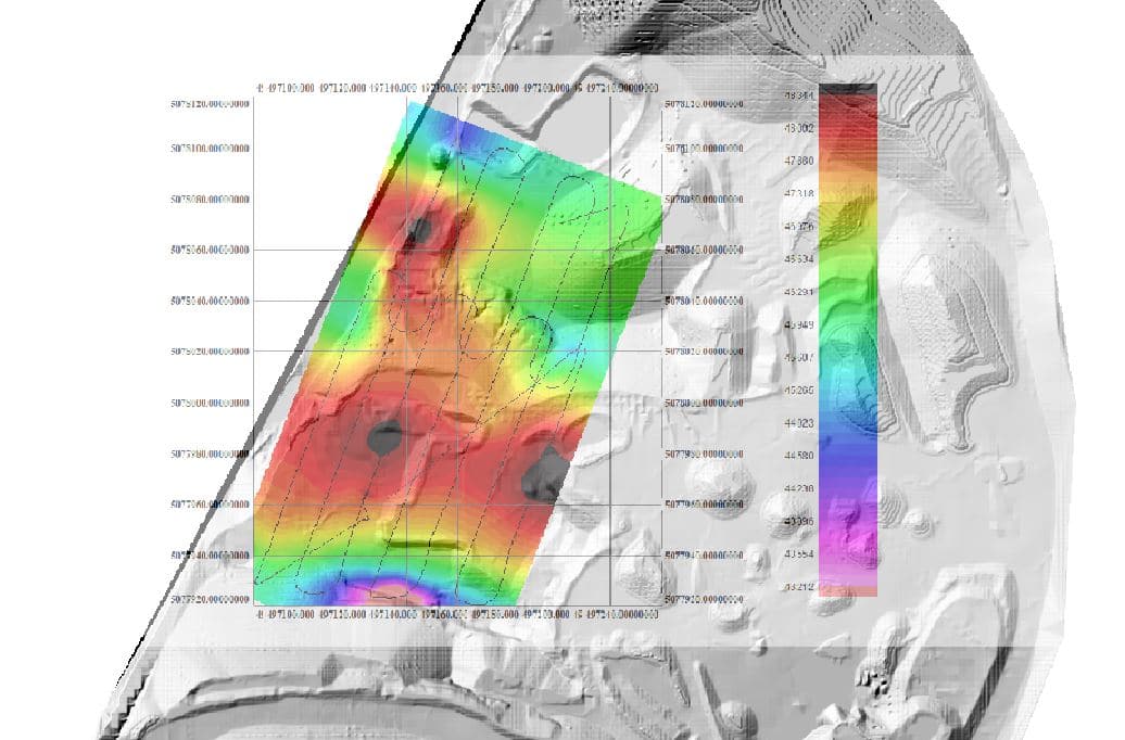
Dans le cadre de notre collaboration avec le bureau d'étude INFOGEO, nous avons récemment réalisé une captation magnétométrique par drone dans une carrière de pouzollanes près de Clermond-Ferrand. La particularité de cette levé est l'altitude de vol puisque nous avons survolé l'ensemble de la carrière à 12m d'altitude en suivant l'altimétrie réelle du site. Cette prestation a été rendue possible par l'intégration d'un MNT récent du site dans notre logiciel de planification de vol. Encore un grand pas franchi par les équipes Instadrone dans la maitrise des captations techniques.
3D achievementsadviceALPHA 7RIVaquatic samplingautonomousbathymetrybuilding information modelingdjidroneengineering structuresformationgpsinnovationinspectioninstadronelidarmicrowave targetingmodelingmultispectralnetworkpathloss reportphotogrammetryprospecting assistanceroof modelingservicessueztelecommunicationwind domainworksite monitoring
  • 0
Instadrone
lundi, 06 avril 2020 / Published in Instadrone-EN

Topography Phantom 4 RTK

For photogrammetric captures that are as precise as they are resolved, the INSTADRONE network uses its DJI Phantom RTK drones.
3D achievementsadviceALPHA 7RIVaquatic samplingautonomousbathymetrybuilding information modelingdjidroneengineering structuresformationgpsinnovationinspectioninstadronelidarmicrowave targetingmodelingmultispectralnetworkpathloss reportphantomphotogrammetryprospecting assistanceroof modelingservicestelecommunicationtopographywind domainworksite monitoring
  • 0
Instadrone
lundi, 06 avril 2020 / Published in Instadrone-EN

Update DJI RTK

In particular, we have validated the use of KMLs on the DSM model for the perfect execution of flight plans thanks to ground tracking.
3D achievementsadviceALPHA 7RIVaquatic samplingautonomousbathymetrybuilding information modelingdjidroneengineering structuresformationgpsinnovationinspectioninstadronelidarmicrowave targetingmodelingmultispectralnetworkpathloss reportphantomphotogrammetryprospecting assistanceroof modelingservicestelecommunicationtopographywind domainworksite monitoring
  • 0
Instadrone
lundi, 06 avril 2020 / Published in Instadrone-EN

SUEZ’s Formation : checked

A look back at in-situ training for SUEZ operators in the context of photogrammetric acquisitions of storage sites.
3D achievementsadviceALPHA 7RIVaquatic samplingautonomousbathymetrybuilding information modelingdjidroneengineering structuresformationgpsinnovationinspectioninstadronelidarmicrowave targetingmodelingmultispectralnetworkpathloss reportphantomphotogrammetryprospecting assistanceroof modelingservicestelecommunicationtopographywind domainworksite monitoring
  • 0
Instadrone
lundi, 06 avril 2020 / Published in Instadrone-EN

Instadrone’s Formation

It was the last day of this week of training synonymous with the validation of the acquired knowledge for our new operators and some old ones of the network.
3D achievementsadviceALPHA 7RIVaquatic samplingautonomousbathymetrybuilding information modelingdjidroneengineering structuresformationgpsinnovationinspectioninstadronelidarmicrowave targetingmodelingmultispectralnetworkpathloss reportphantomphotogrammetryprospecting assistanceroof modelingservicestelecommunicationtopographywind domainworksite monitoring
  • 0
Instadrone
vendredi, 01 novembre 2019 / Published in Instadrone-EN

SONY ALPHA 7R IV

The Instadrone network has equipped itself with the SONY Alpha 7RIV camera in order to offer more and more details in our inspections and orthophotographs.
3D achievementsadviceALPHA 7RIVaquatic samplingautonomousbathymetrybuilding information modelingdjidroneengineering structuresformationgpsinnovationinspectioninstadronelidarmicrowave targetingmodelingmultispectralnetworkpathloss reportphantomphotogrammetryprospecting assistanceroof modelingservicestelecommunicationtopographywind domainworksite monitoring
  • 0
Instadrone
samedi, 20 juillet 2019 / Published in Instadrone-EN

DRONES GEOPHYSICS

New combined acquisition of Lidar and magnetometric data in order to produce a 3D geological model with our partner CVA Group.
3D achievementsadviceALPHA 7RIVaquatic samplingautonomousbathymetrybuilding information modelingdjidroneengineering structuresformationgpsinnovationinspectioninstadronelidarmicrowave targetingmodelingmultispectralnetworkpathloss reportphantomphotogrammetryprospecting assistanceroof modelingservicestelecommunicationtopographywind domainworksite monitoring
  • 0
Instadrone
mercredi, 26 juin 2019 / Published in Instadrone-EN

INSTADRONE MOROCCO

As part of our development, we have recently set up an Instadrone agency in Morocco
3D achievementsadviceALPHA 7RIVaquatic samplingautonomousbathymetrybuilding information modelingdjidroneengineering structuresformationgpsinnovationinspectioninstadronelidarmicrowave targetingmodelingmultispectralnetworkpathloss reportphantomphotogrammetryprospecting assistanceroof modelingservicestelecommunicationtopographywind domainworksite monitoring
  • 0
Instadrone
lundi, 24 juin 2019 / Published in Instadrone-EN

Instadays 2019

From 04 to 08 June, Instadays 2019 took place at the Techno Centre Instadrone in SERVIAN.
3D achievementsadviceALPHA 7RIVaquatic samplingautonomousbathymetrybuilding information modelingdjidroneengineering structuresformationgpsinnovationinspectioninstadronelidarmicrowave targetingmodelingmultispectralnetworkpathloss reportphantomphotogrammetryprospecting assistanceroof modelingservicestelecommunicationtopographywind domainworksite monitoring
  • 0
Instadrone
mardi, 15 janvier 2019 / Published in Instadrone-EN

Start of Lidar capture

Lidar capture is off to a strong start at the beginning of the year, as we have surveyed 100 hectares on a single day for the installation of photovoltaic panels.
3D achievementsadviceALPHA 7RIVaquatic samplingautonomousbathymetrybuilding information modelingdjidroneengineering structuresformationgpsinnovationinspectioninstadronelidarmicrowave targetingmodelingmultispectralnetworkpathloss reportphantomphotogrammetryprospecting assistanceroof modelingservicestelecommunicationtopographywind domainworksite monitoring
  • 1
  • 2
  • 3
  • 4

Recent Posts

  • CAS D’USAGE FORMATION / LOCATION DRONES

    Depuis maintenant 4 ans, SUEZ loue des drones à...
  • Livraison médicale par drone

    INSTADRONE GROUP est heureux de participer à la...
  • DJI Dock 3 chez COVED – PAPREC GROUP

    Nous vous avions annoncé le début des vent...
  • Instadrone au Forum EnerGaïa

    INSTADRONE GROUP sera présent au Forum EnerGaïa...
  • AGRICULTURE – Recherche opérateurs

    Hier s’est tenue la réunion de préparatio...
Logo POCTEFA
  • RÉSEAU
  • SERVICES
    • TÉLÉCOMMUNICATION
    • TOPOGRAPHIE
    • INSPECTION – PRELEVEMENT
    • PRESTATIONS AGRICOLES
    • INSTADRONE ACADEMY
    • COMMUNICATION
  • ACTUALITÉS
  • CONTACT
  • Français
    • Français
    • Español
  • MENTIONS LÉGALES
  • Poctefa
  • GET SOCIAL

© 2025 INSTADRONE - Tous droits réservés

TOP
Nous utilisons des cookies pour vous garantir la meilleure expérience sur notre site web. Si vous continuez à utiliser ce site, nous supposerons que vous en êtes satisfait.